


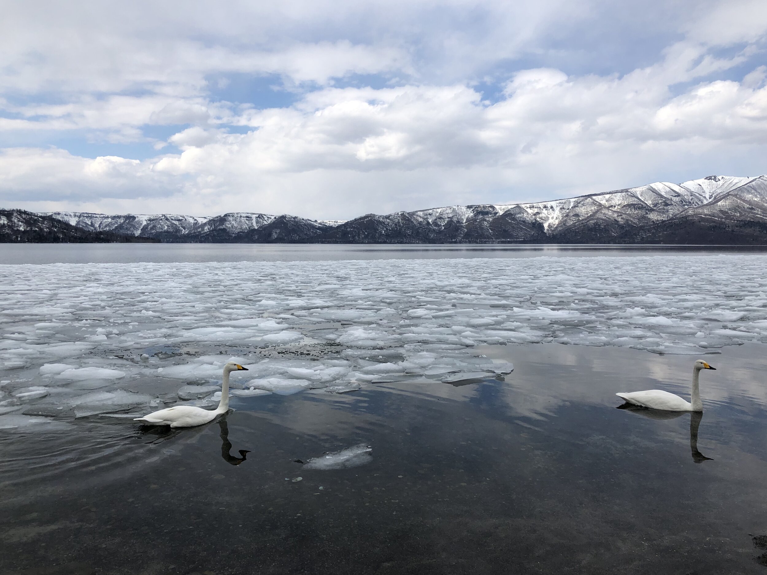


Hokkaido: Day 1
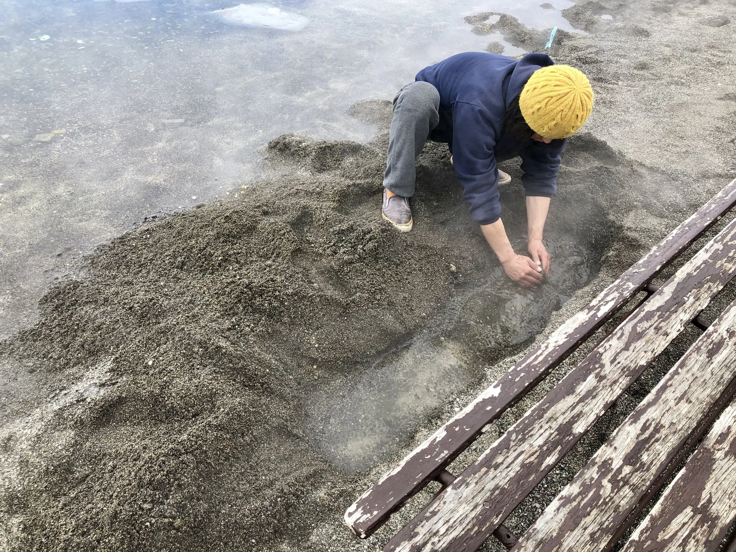
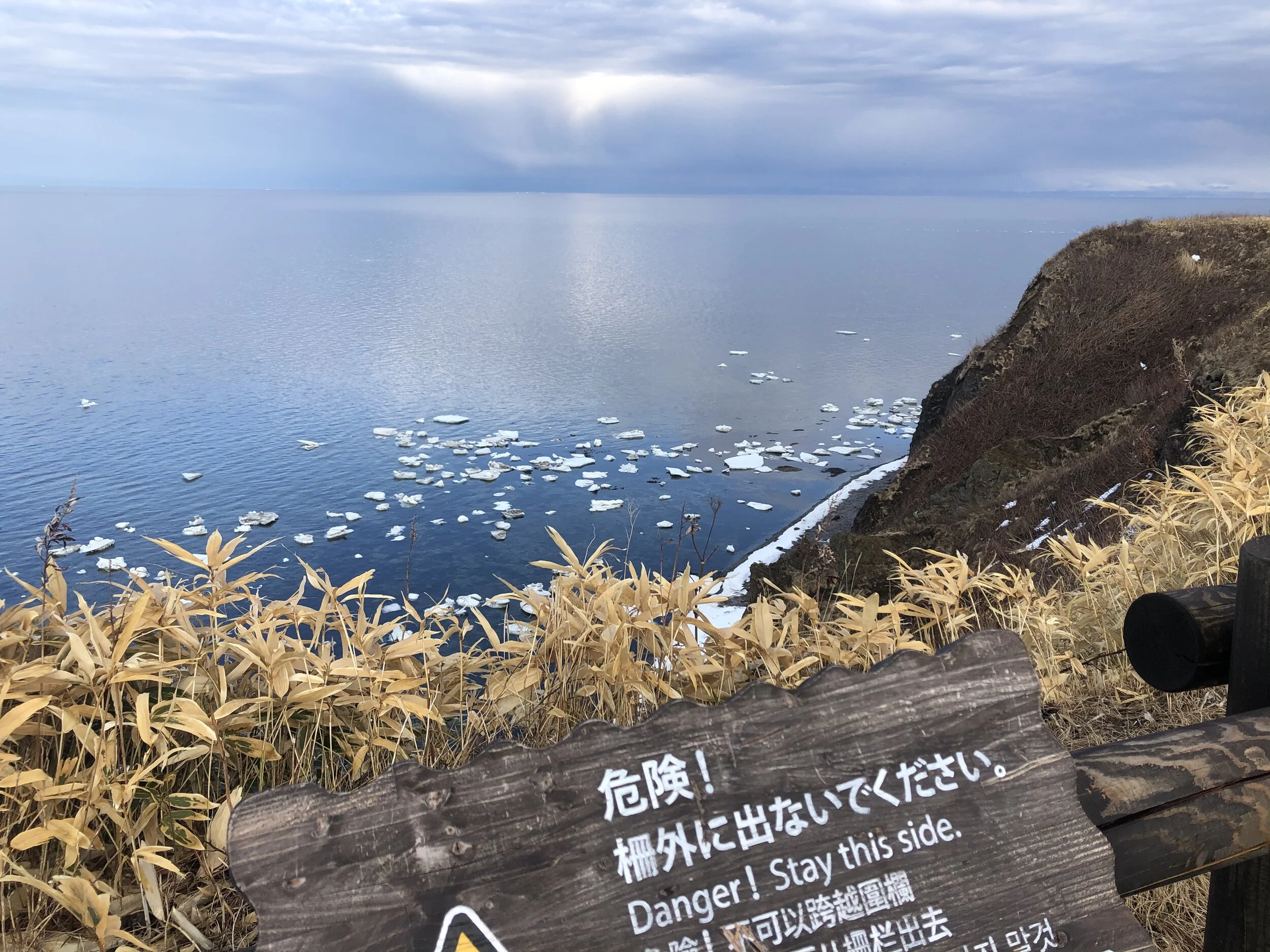
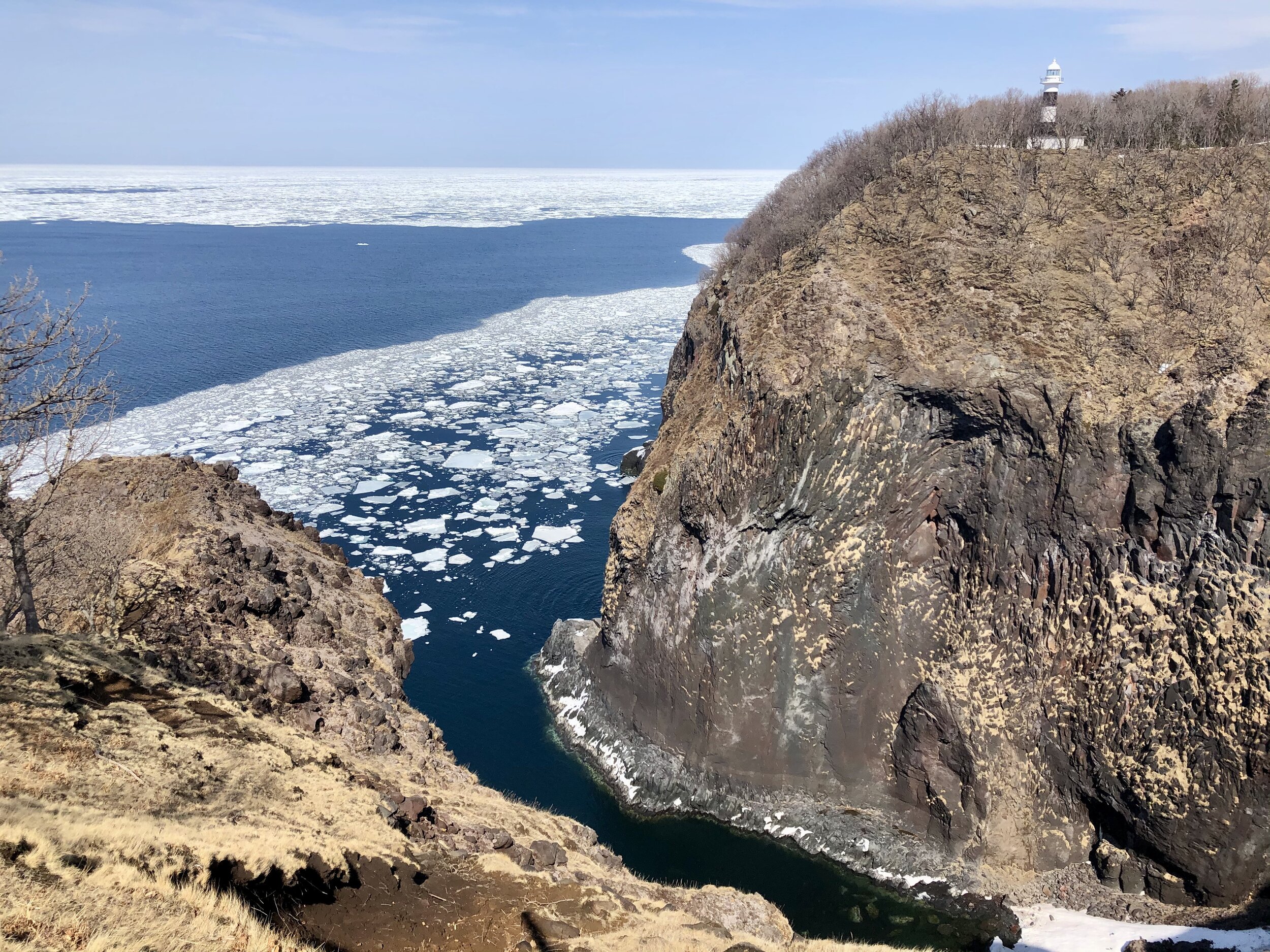
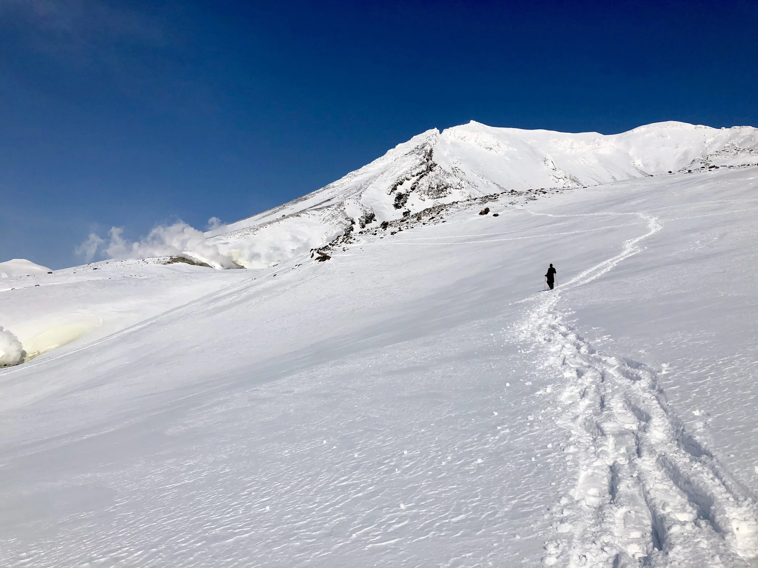
Today begins the weeklong tour of Hokkaido! I have wanted to go to Hokkaido for a long time. It’s the northernmost Japanese island and the least populated. It’s known for its wilderness, wildlife, deep forests, and mountains. Today we visited Asahi-dake (Mount Asahi), the tallest mountain in Hokkaido at 2291 meters (7516 feet). Up we went to the tippy top where snow was still blanketing the ground. Almost no one was there, as coronavirus has scared away most travelers, but also because spring is upon us and the snow was heavy from melting. While at Asahi-dake, I snowshoed for the first time. I got caught in some deep snowdrifts, but managed to pull myself up. We saw some fresh avalanches and the rapid steam of the thermal vents (it is a volcano after all).


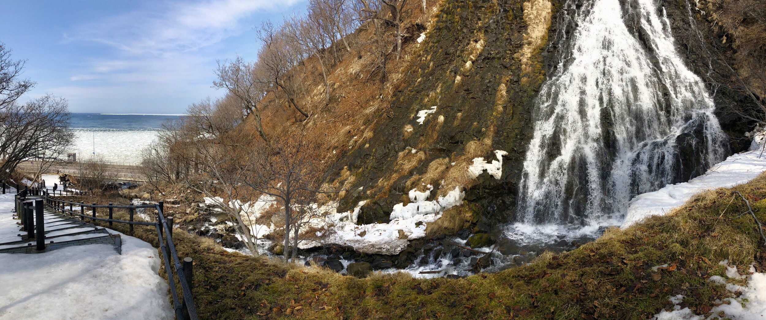
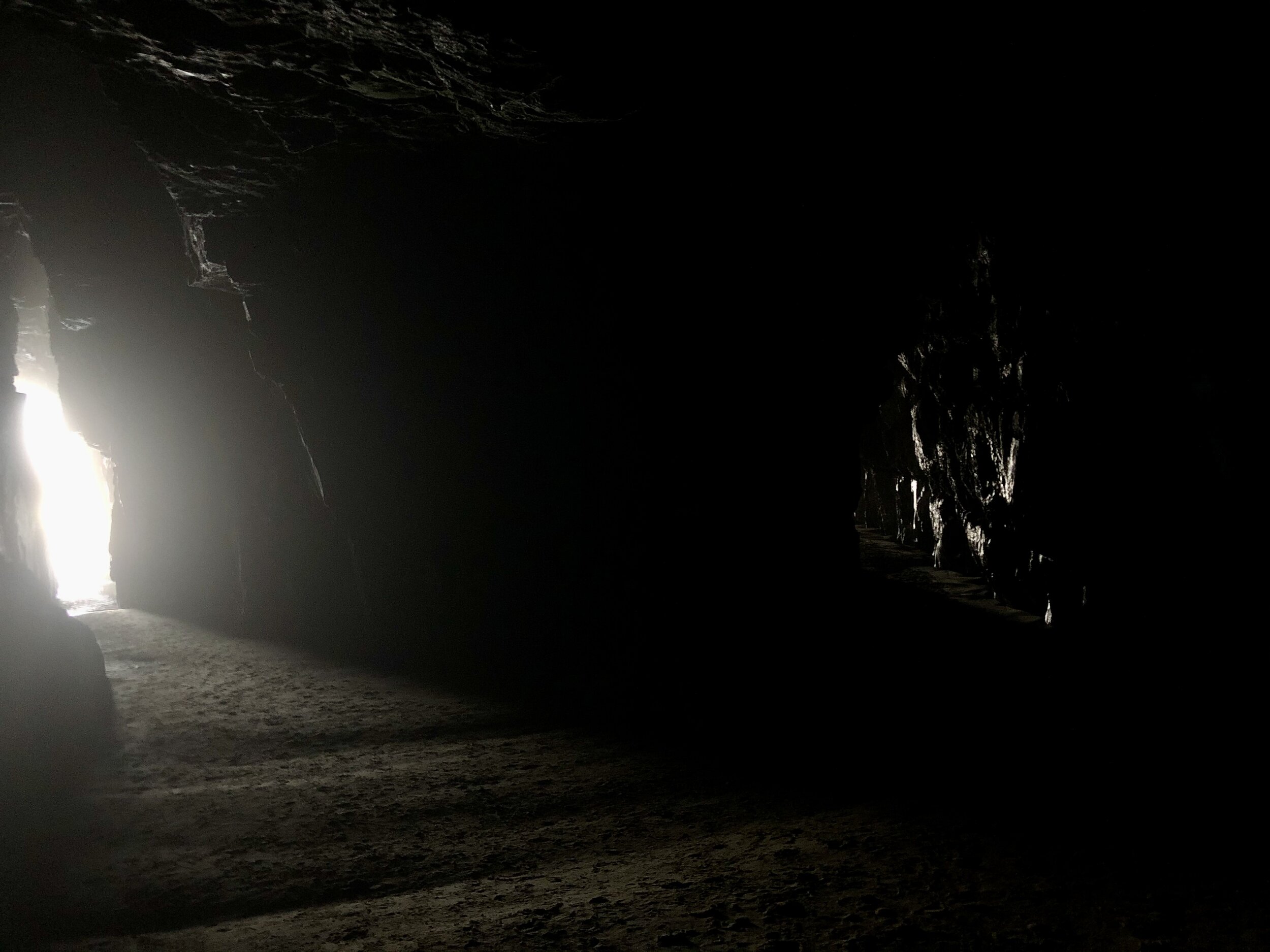
Not only did we see Hokkaido’s tallest mountain, but we also saw Hokkaido’s tallest waterfall! So we really peaked on the first day. To snowshoe into the water fall, aka Hagoromo Falls in Tenninkyo Gorge, we had to walk past an abandoned lodge, which was quite eerie. It’s still a popular place for hikers, so the area is well-maintained.


Sayonara!

Boracay, Philippines
Boracay is a microcosm of what we see happening in places all over the world: both too much and not enough love from tourists as well as from those sanctioned to protect it. This island is known for its beautiful white sand beaches and turquoise water. I can only imagine what Boracay used to look like many years before human development, but also right before the island shut down to tourists April-October 2018 for a massive environmental cleanup. The Filipino president, Rodrigo Duterte, (yeah, the one also connected to the killings of over 1,000 drug dealers, petty criminals, and street children in the Philippine “War on Drugs”) declared Boracay a “cesspool.” Many of the island’s resorts were channeling untreated sewage directly into the ocean, and other resorts were built on protected wetlands. Beachgoers came from China, Korea, Europe, and Australia to party hard, drink on the beach, and throw their trash directly onto the ground. The beaches became so polluted that algae grew exponentially, muddying the once-clear water. People weren’t allowed to walk barefoot on the beach due to all the broken glass. The 7km long/1km wide (a little less than 4 sq miles) island had over 2 million visitors over the course of a year at its peak. The dirt streets were filled with ruts from the many motorcycles and trikes shunting tourists and locals to and fro. Even now, the pervasive smell of trash still permeates some parts of the island.
And on top of all of this, Typhoon Ursula reared her watery head on Christmas Day, 2019, causing major damage to many of the homes, businesses, and resorts all over the island. Even still, corrugated metal has been ripped from the rooftops and lays crumpled on the ground tangled power lines litter the sides of the streets and are caught in trees, , causing danger for trucks passing by, which can snag and pull the power lines down.

And that is to mention nothing of the terrestrial wildlife here. The most common animals I have seen include the Eurasian tree sparrow and feral dogs and cats. Handfuls of bats fly out from the palm trees at dusk. But that is roughly it for wildlife. The permanent population of humans is nearly 40,000. The Associated Press reported that a limit of 6,000 tourists are allowed on the island daily, while The Thaiger, a southeast Asian newspaper, claims that guests are limited to 19,200 at any given time. That means that, assuming the number of visitors is at a low estimate (it’s presumed peak of 19,200), that is roughly 59,000 people in 4 square miles. Regardless, multiple local business owners have told me that the number of tourists has not changed before and after the shutdown. When the island opened again in late 2018, a series of regulations were put in place for tourists. The AP article also mentions that officials said, “Visitors [...] will be asked to sign an oath to follow the new rules, including proper waste disposal.” Did I have to sign an oath? No. Do I know what proper waste disposal is? I mean, I don’t place my discarded things on the ground and run away, but there is no separate option for recycling in my hotel room trash. Do I think the housekeepers go through trash to bring out recyclables? Maybe, but probably not.

One silver lining: if regulations were strictly followed, I would probably not have been allowed in due to the amount of public vomiting I have been known to emit.
Most blatantly, single use plastics are NOT banned on the island. Some resorts, like the Henann Crystal Sands, have removed plastic water bottles from their hotel rooms in lieu of refillable pitchers (with freshwater filtration systems in each hallway). Though the tap water is labelled unsafe to drink, the resort owner mentions in Hennan’s magazine Sands that he always drinks the tap water with no problems. Yet still, single-use wrap is pervasive: the hotel slippers come wrapped in it, as do the saran wrap over the room service meals (instead of a plate cover, for example). And that’s just at the resort. Supermarkets and convenience still sell single-use plastics. Restaurants right on the beach serve bottled water.
On the trike ride into town (a common way of getting around Boracay), a guide told me that one of the resorts (I think he was referencing just one, although he could have meant all resorts combined) exports a total of 50 tons of trash per day, which he attributed to mainly Chinese tourists.
Speaking of which, this is an oddly excellent time to be on this island, if ever. I acknowledge completely that my existence here contributes directly to many of the issues that this island faces. However, over 20,000 locals rely on jobs related to tourism, and with the advent of the coronavirus, revenue has declined. Many restaurants have closed indefinitely due to the decline in tourism from coronavirus. 70% of the tourism here (according to a local hostel owner) comes from Chinese and Korean tourists. People from both countries are currently barred from entering Boracay, so many of the resorts and restaurants have far fewer customers than usual and are offering major discounts (hence staying at Hennan Crystal Sands!! Yesterday I got a 90-minute long body/foot massage and facial for the equivalent of $26!!!).
Perhaps in part because of staying in a resort, or part because of the essential character of Boracay, I have felt much more removed from nature/the natural environment than anywhere else on this trip so far. Yes, the beaches are beautiful, but nothing is left untouched by a human hand. The only birdsong are those of sparrows, the mice of the bird world. What is this place? What has been here for so long was destroyed in an instant, with beautiful remnants still. I don’t know what I am missing, and neither do most of the people who venture to this paradise. Here I see, as with many places in which top notch amenities for tourists juxtapose the local poverty next door (think: Cancun, India, Jamaica), people trying to survive as best as they can, and by doing so, inviting tourists that (in the absence of environmental protection) inadvertently destroy the very thing that they come to seek: the beauty and tranquility of the ocean. It is one of the oldest stories in the book, repeated ad infinitum. But it doesn’t HAVE to work like this. The mayor and 16 other government employees were suspended for ignoring important environmental regulations before the island shut down. A claim of reformation and the lazy facade of change (beach signs that aren’t followed) - politicians must be held accountable, as do the business owners, officials, and most importantly, the tourists themselves.

Cathedral Caves
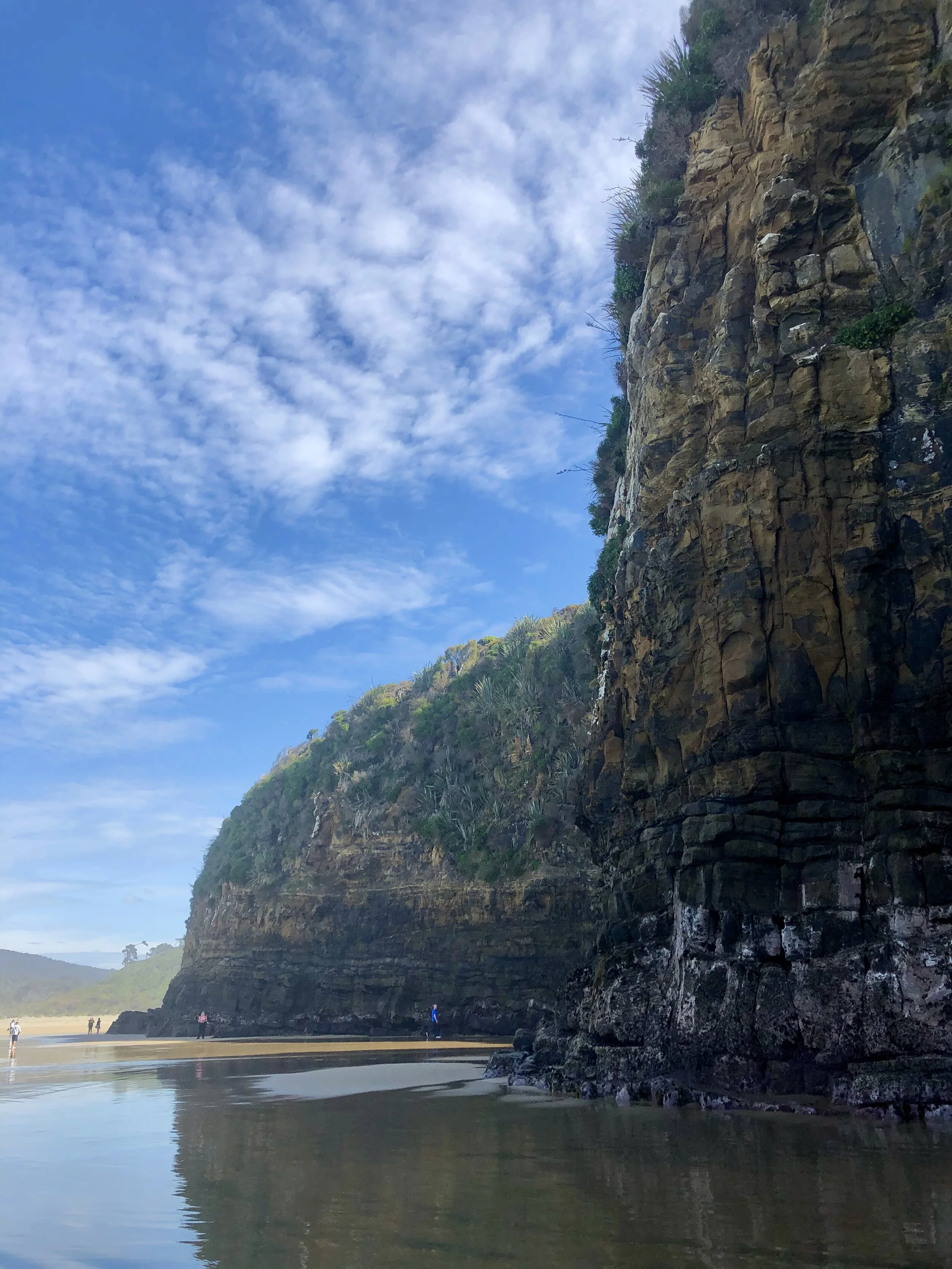
Cathedral Caves left me out of breath. In part because of their beauty, but also because 45 minutes were spent sprinting from cave (cathedral) to cave (cathedral) before the tide began to advance. These massive limestone caves are known for their acoustics (dream: an orchestra playing right where I stood in the image below, or perhaps the chanting of Gregorian monks, or the strum of Joanna Newsom’s harp). And indeed, they are reminiscent of old European cathedrals: long, narrow rooms with massive arched ceilings. Altogether, they add up to nearly 200 meters (656 feet) deep and roughly 40 meters (100 feet, or slightly less than 10 stories) high. The caves are only accessible for 2 hours before and after low tide. On this particular day, low tide was at 11:06am, and the carpark closed at 1:15pm. It is about a 1 km hike to get to the beach area, so after arriving around 12:00pm, the tide was already beginning to advance. The race was on!
There are two main caves that most tourists find. BUT, just beyond a rock outcrop, there are even more caves! And then beyond another rock outcrop, there are even MORE caves! [Cut to scene of me sprinting through thigh-level water as it crashed against the rocks and I struggled to keep secure footing.] The most esteemed guidebook, NZ Frenzy, told of wonders beyond the original two caves. I was looking for some magical penguin den (!that I would stay at least 10 meters away from!), or an inner-cave waterfall. But nay! However, there was a cool little trickle of water (see 2nd to last cave picture). And it was fun to sprint as the water receded and then stay perfectly still and brace myself as the water rushed again over my ankles and up my legs. I’m living proof that I survived.


It is worth noting that Cathedral Caves are on "Māori land”. As with many countries colonized by Europeans (and in the case of NZ, largely British subjects), the native people were tricked out of their original land, only to be given the leftover bits of the least desirable parts of the country - the places where it was difficult to make any living off the land (think Cherokee in Oklahoma or Navajo in the four corners region of the US). The Māori too were allocated land that had no real agricultural or economic value, as mentioned by the Cathedral Caves website:
“At the turn of the 20th century, the New Zealand Government decided to reserve land for descendants of Māori who had been adversely affected by Government and private land purchases in the 1840s and 1850s. The South Island Landless Natives Act (SILNA) 1906 was intended to provide redress for the economic hardship afflicting Māori who had lost their customary lands and the means to support themselves. Under the legislation, the Government (Crown) allocated 57,500 ha of land, much of it in southern South Island and Stewart Island, to about 4,000 Māori. At the time of their granting, these SILNA lands were among New Zealand’s least valuable – remote, rugged, wet, unsuitable for farming and often far from traditional home areas.”

Now, the land given to the 4,000 Māori individuals has been divided up into parcels. Precisely 234 Māori descendants own a claim to this particular piece. The highlighted bits in the below image are the particular section encompassing Cathedral Caves.

The 6 highlighted sections make up the “Tautuku Block X Section 3C Trust,” which the 234 Māori have a stake in.
It is worth nothing that the division of the government that oversees the Māori land is the Ministry of Justice…
New Zealand likely has had the most civilized response to their oppression of native people that I have seen anywhere in the world. That is not to say it is perfect. And it is not to excuse the actions of the European settlers. But yet, New Zealand seems like it is actually really trying, and has been quite successful at making amends with the native Māori. For instance, there are dual language signs nearly everywhere you go. “Kia ora” is a common greeting said just as frequently among white people (and is not considered cultural appropriation). Which leads me to consider the next logical question: what if the US took Native American language and culture as seriously as it did European heritage? There is a feasibility argument here: America had hundreds (thousands?) more tribes than New Zealand, with vast linguistic and cultural differences, and to include them all in the mainstream (e.g. dual-language signs, honoring sacred areas) would be nearly impossible (in part because many of those areas no longer exist). But what might be even better? To consult with the descendants of those Native Americans that the US relegated as out-of-sight/out-of-mind. To ask them what they want and what they need. Why New Zealand appears in such stark contrast with the US is simple: NZ chooses to ask and listen to the people whom it has suppressed for over a century and work toward progress (yes, ever-imperfect, but an open dialogue nonetheless).


The trail leading back up to the carpark.
At any rate, I suspect that no matter who you are or whether or not you know the feel of an ancient European cathedral, you are left with a sense of awe at the cavernous possibilities that crashing waves can create, including a moment to catch your own breath.

Kepler Track: Part III
Day 4: Moturau Hut to Rainbow Reach (6 kms).


Spirit Lake


Waiau River (and also the place of filming for the Anduin River in Lord of the Rings)


Waiau River pt. 2

Probably the best cautionary sign I’ve ever seen.

Finally on the road back to rest.

Kepler Track: Part II
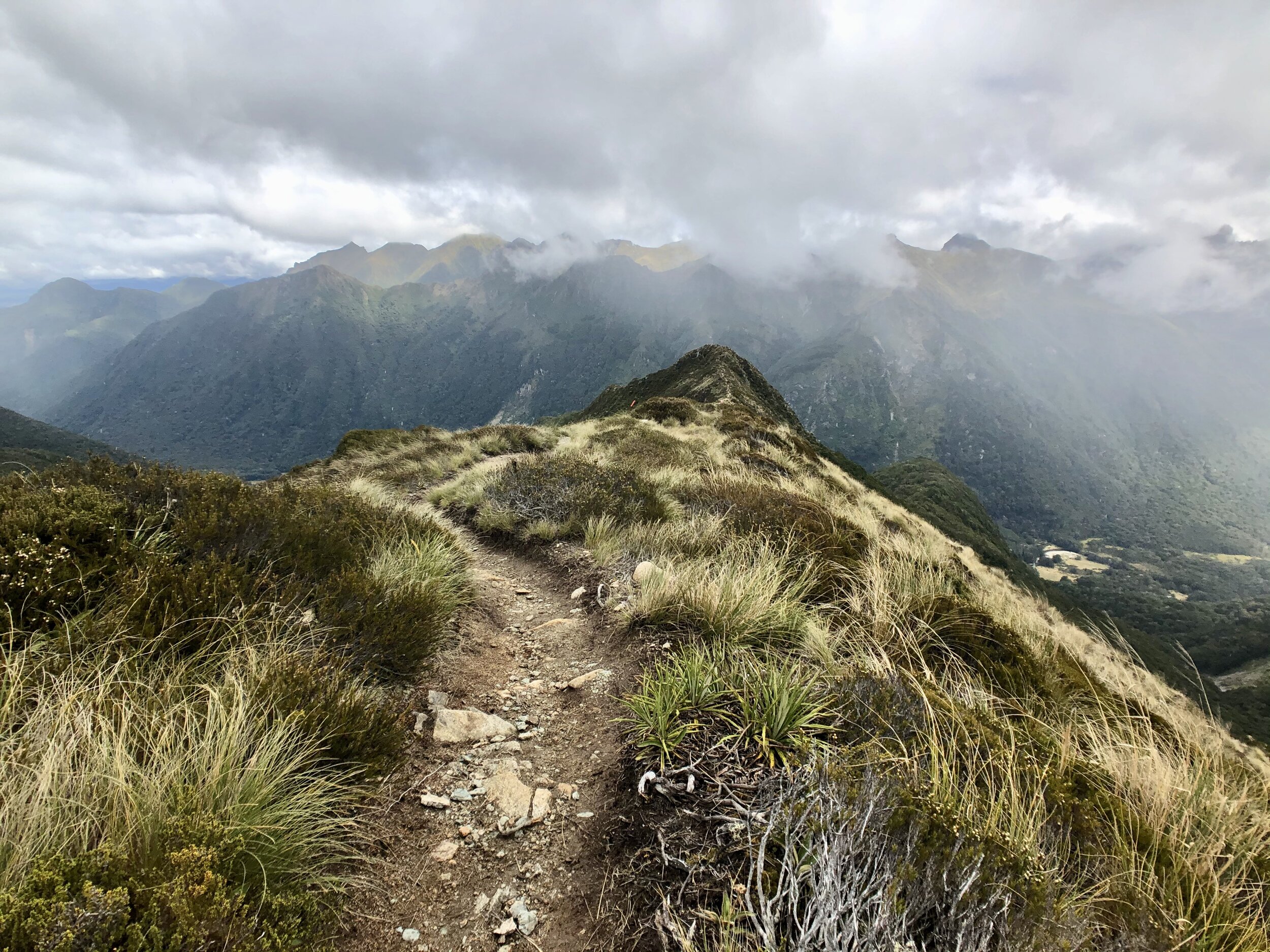
Day 2: Luxmore Hut to Iris Burn Hut: 14.6 kms (8.9 miles).
*Note: a burn comes from a Scottish/Northern English word for a small stream; a brook. Since NZ was colonized by folks from Great Britain, a lot of these words are still present today.

On Day 2 of the hike, after climbing to the summit of Mt. Luxmore, we were greeted by a kea, the world’s only species of alpine parrot! Many of the kea in this area are banded, and if you can see or get a picture of a kea with its band, you can upload it to a database called www.keadatabase.nz, where a team of volunteers will parse through photos and record observations. This king of the mountain is named Shae and was banded only last summer (July 2019). He’s commonly seen around Luxmore Hut as well!
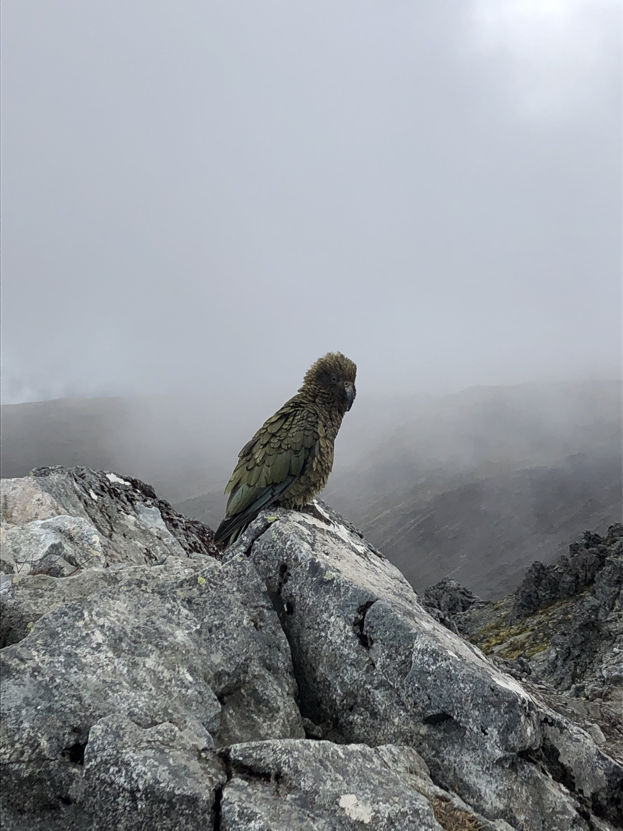
In total, I counted 10 kea along the trail. Shae was the only individual that I could see was banded, but I still recorded all my other observations. The cutest kea are the juveniles, in my opinion. Even though they are as large as their parents, they have bright yellow rings around their eyes and squawk and follow their parents around helplessly.

Kea adult in foreground and adolescent in background. See the bright yellow ring around its eye?


Day 3: Iris Burn to Moturau Hut: 16.2 km (9.8 miles).
For some reason I took almost no pictures on this stretch. It was beautiful though, mostly mossy forest.